
Walk a Champaign County Street
A street-by-street search works best as a chain, not as one broad name query. Start with the exact address and determine which government has jurisdiction. Then preserve the parcel identification number, or PIN, because it connects the map, tax account, assessment questions, and recorded-deed leads. Ownership and occupancy are not the same fact. County property systems can identify an owner or taxpayer, while an older directory, newspaper, or other dated source may support who lived at the address.
- Normalize the full address in a CCGISC map or the municipal address tool. Save the jurisdiction, USPS place name, ZIP code, PIN, and retrieval date.
- Open the county tax lookup with the PIN or the formatted house number and street. Compare the property location with the map rather than assuming the mailing label proves city limits.
- Use the CCGISC Recorded Deed History search by PIN. Treat the result as a lead because the public display may show only one grantor and one grantee.
- Check both city permit systems when the property is in Champaign. Older and newer projects are divided at the start of 2025.
- For an earlier household, search old numbers and names in local street and criss-cross directories, then corroborate with maps or newspapers.
This sequence keeps the Champaign County street directory tied to dated records. It also makes a negative result easier to explain. A missing hit might mean a changed street number, a portal cutoff, a record held only at a counter, or a source that never indexed occupants.
Search Champaign County by Address
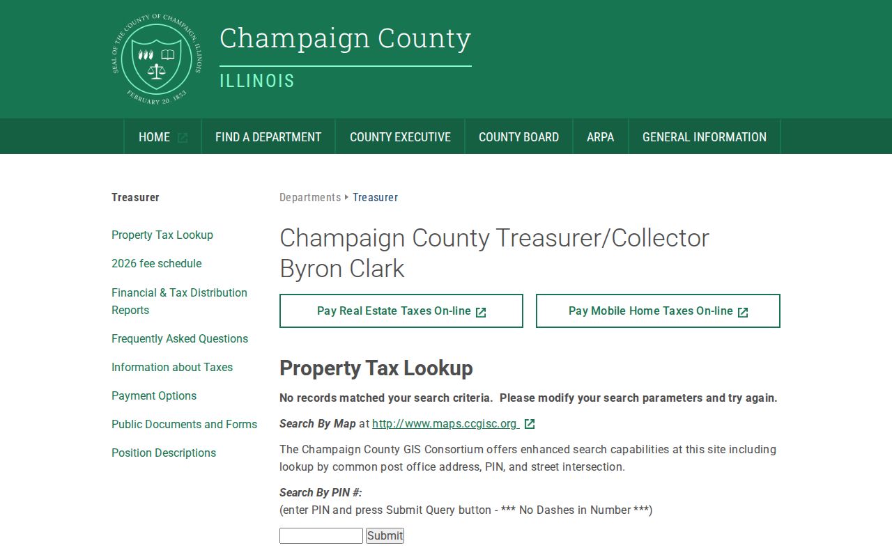
The Champaign County Treasurer property-tax lookup accepts either a PIN without dashes or a property-location search. The address route separates the house number from the street and gives special format guidance for suffixes and rural addresses. It is a strong first check when a street name is known but a parcel number is not.
| Search field | How to use it |
|---|---|
| PIN | Enter the parcel identification number without dashes. |
| House number | Enter the numeric part of the property location. |
| Street | Follow the county's suffix and rural-address instructions. |
| Submit Query | Review the returned parcel and tax context against the mapped address. |
The screenshot below shows the county's real property-location and PIN entry points. It is useful evidence of how the official form expects an address, but the research did not establish a clean online historical cutoff.
Keep the result year and retrieval date in the research log. Older assessment cards or a question about an exemption should go to the Assessment Office rather than being inferred from a current screen.
Map Champaign County Street Parcels
The CCGISC public map supplies parcel geometry, aerial context, intersections, and layers for such topics as assessment, zoning, districts, and addresses. Map output is a general index, not a legal survey. A street directory search should preserve both the mapped parcel and its source date, since boundaries and address data can change.
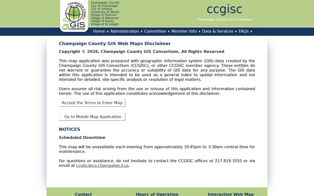
The viewer helps a reader move along adjoining parcels without turning the result into a list of people. CCGISC also offers staff help, data requests, large prints, scans, and licensed products. The public map has a stated overnight maintenance window, so a blank screen during that period is not a negative property result.
For an address inside Champaign, the city address map can help establish whether the point lies within city limits, along with coordinates and an aerial date.
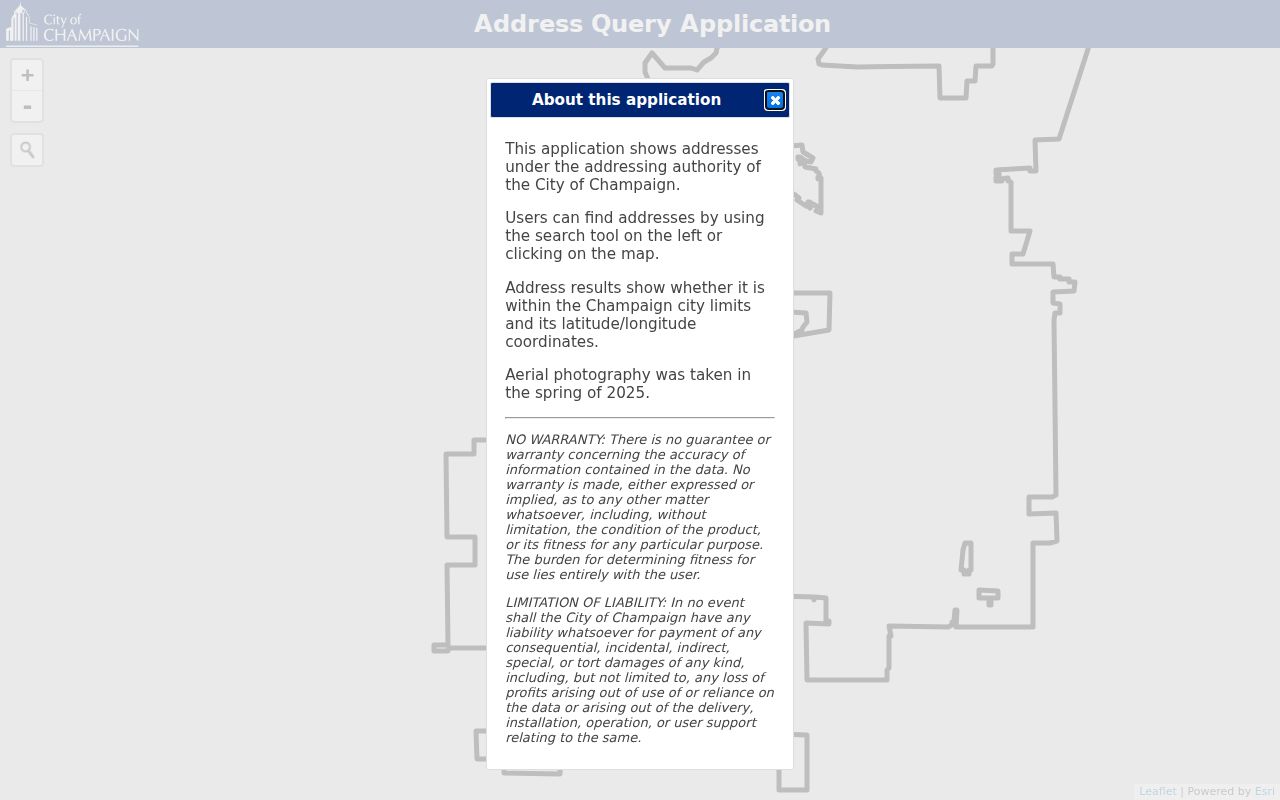
The exact interactive field labels were not exposed in the research crawl, so use the live tool as shown and do not claim an unverified search option.
Follow Champaign County Deeds
Once a PIN is known, open the CCGISC Recorded Deed History. Its inspected controls include Order Results By, Order Direction, Search PIN, and the search control. The county warns that the display is deed-only and may show just one grantor and one grantee even when a document has more parties. A grantor transfers an interest; a grantee receives it.
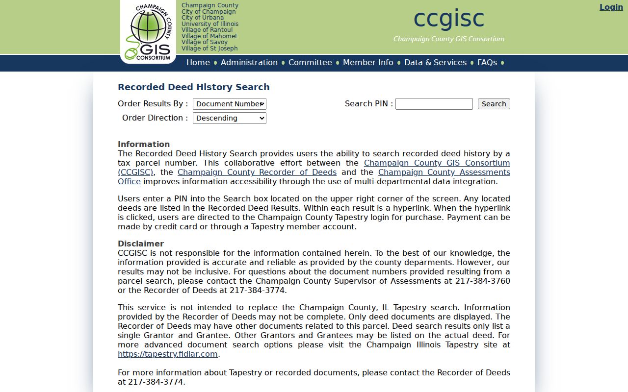
The result can lead to Tapestry for a recorded image. Tapestry is an external paid or account-based service, and its current Champaign County fields, price, and online coverage cutoff were not established in the research. The Clerk and Recorder counter, written request route, title abstracts, and deed books remain the fallback when the public lead is incomplete.
Two Champaign Permit Searches
Permit research has a firm portal split. Projects through December 31, 2024 remain in legacy eTRAKiT, while permits from January 1, 2025 forward use OpenGov. Search both when work may cross that date. A permit may corroborate an alteration or use at an address, but it does not prove who occupied the property.
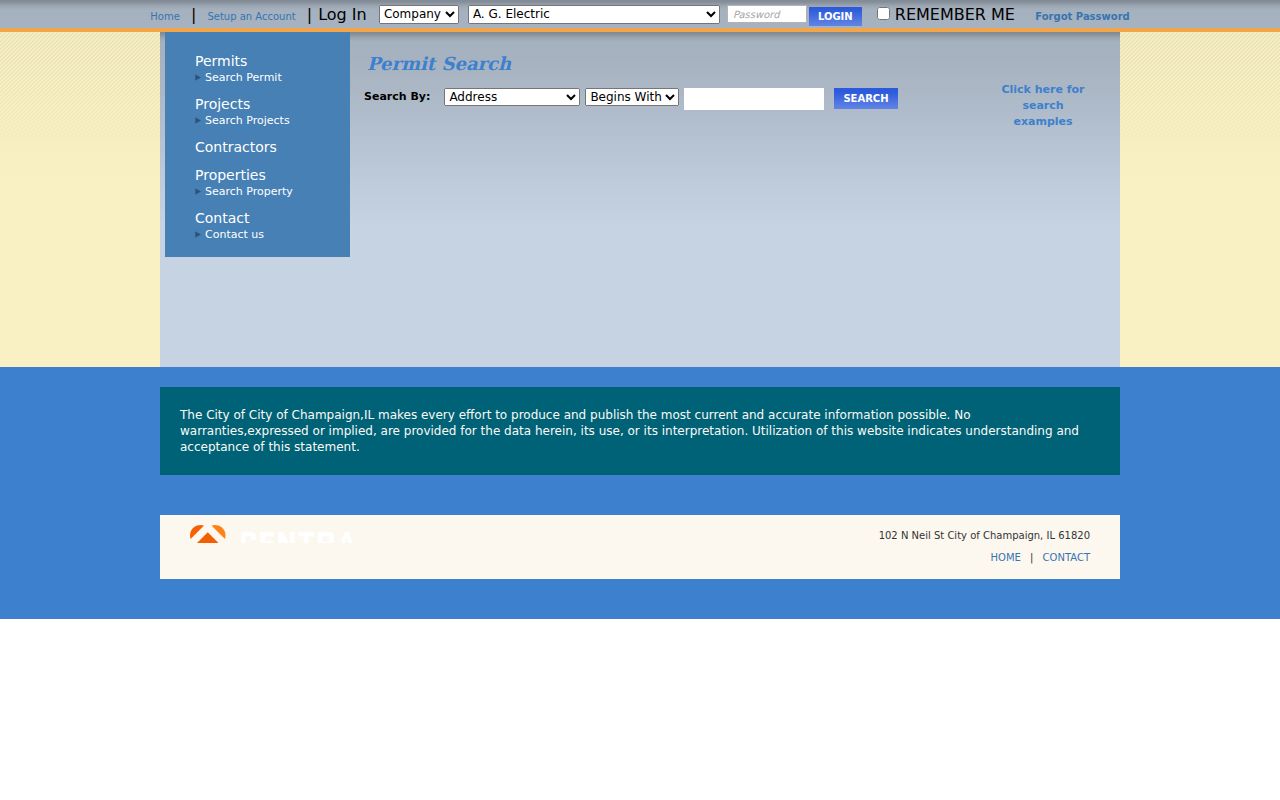
The legacy screenshot records the older search surface and its tabs. Exact result coverage should still be checked against the project date and address.
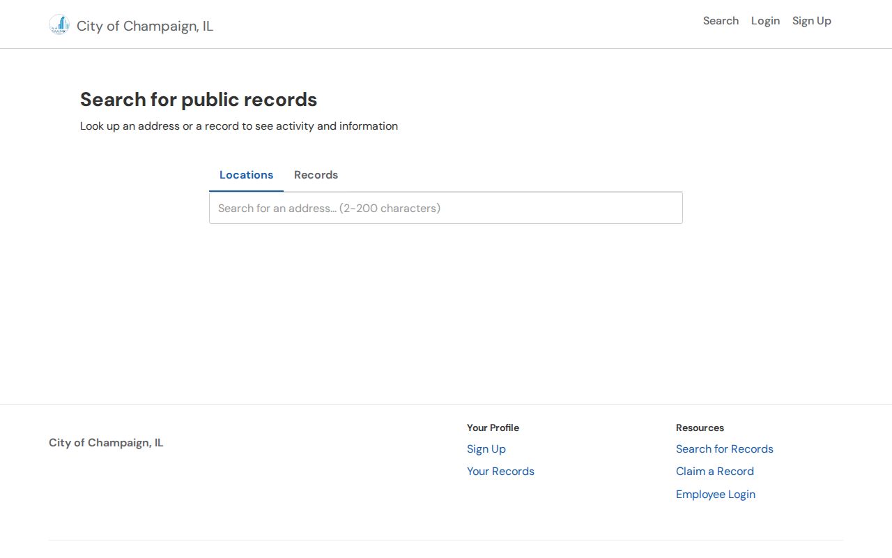
The current screenshot marks the newer side of the split. Building Safety, the City Clerk, and a focused FOIA request provide alternatives for records that are not searchable online. Ask for an address and date range, plus electronic copies or an inspection option, rather than an open-ended person file.
Champaign County Street Record Coverage
No one roll provides a complete street directory. The address-keyed sources below differ in keeper, meaning, and access. Reading them together can show parcel context and dated changes while keeping owner, occupant, and mailing address separate.
| Record Set | Keeper | What It Shows | Access |
|---|---|---|---|
| Tax and assessment | Treasurer and Assessment Office | Parcel, tax-year, value, and assessment context | Online lookup; office for older cards and questions |
| GIS parcel map | CCGISC | Geometry, PIN, aerial and jurisdiction layers | Public map; staff, print, and data routes |
| Recorded deeds | County Clerk and Recorder | Transfer leads tied to a PIN | Public deed history; paid image or office fallback |
| Permits | City of Champaign Building Safety | Dated project and alteration records | eTRAKiT, OpenGov, office, or FOIA |
| Directories and maps | Urbana Free Library, CCHA, UIUC | Dated occupants, old address forms, built context | Digital scans, non-circulating holdings, staff retrieval |
The PIN ties modern parcel sources together. The street text connects records that predate the current parcel database. Illinois voter registration lookup is a private status check requiring a real person's name, birth date, and ZIP, not a public street-browse directory. Do not scrape it or publish a returned address.
Decode Champaign County Addresses
Champaign County records may hold several valid labels for one place. The USPS city name can differ from an incorporated municipality. Historical volumes may use Urbana, West Urbana, Champaign, East Urbana, a township, ward, or post-office label. Store those values separately and search each plausible form.
- Parcel
- A mapped tract of land identified locally by a PIN.
- Situs address
- The physical location assigned to a parcel, which may differ from the owner's mailing address.
- Plat
- A recorded map that lays out lots, blocks, streets, or a subdivision.
- Criss-cross directory
- A directory arranged by address or phone number rather than only by surname.
This vocabulary prevents a common error: treating a tax-mailing address as the place where someone lives. It also makes the street directory usable across city, county, USPS, and historic records without forcing unlike fields into one label.
When Champaign Streets Changed
Old street names and numbers can make a correct household vanish. A local-history account describes postal confusion from 1911 to 1913, an August 1913 Champaign ordinance, and 1914 changes that included First South becoming Chester, Second South becoming Logan, and Third South becoming Marshall. Use that account as a lead, then corroborate the exact address with an ordinance, map, directory, or deed.
The Robert D. Carmichael House offers a better documented address-change example. Its historic survey ties today's 207 W Washington Street in Urbana to an original 305 W Washington address and a change around 1918 after Race Street moved half a block west. The same survey links a PIN, directories, historic owners and occupants, and Sanborn map years. That is why an old and new address should remain separate fields.
Street Maps Across Champaign County
Physical evidence can explain why an address looks wrong. Champaign's preservation resources list maps from 1858, 1869, and 1884, a long run of historic aerials from 1936 through 2014, and guidance for Sanborn fire-insurance maps. Sanborn sheets show lot, block, house number, building footprint, construction, and use. They do not form a resident list.
Title abstracts add a paper trail that can include deeds, mortgages, releases, tax sales, easements, surveys, plats, annexations, restrictions, liens, special taxes, utility assessments, and mineral rights. Urbana Free Library catalogs about 5,600 abstract files. Search by its stated street-name, town, direction, and house-number format, or use the advanced town and township fields outside Champaign-Urbana. Local-improvement files may also explain paving, sidewalks, utilities, and a changed parcel description.
Check a Missing Street Result
A blank portal result is not proof that no record exists. Log the exact address, spelling, PIN, ZIP, municipality, system, and search date. Then try old numbers, directions, suffixes, townships, neighboring directory years, and a second custodian. The next route may be the Clerk and Recorder counter, Assessment Office, CCGISC staff, City Building Safety, Urbana Free Library, CCHA, or IRAD.
Some online details were not exposed during research, including the live DevNet fields, precise assessment cutoff, CCGISC interactive input labels, and current Tapestry coverage. State the gap. Do not fill it with an unsupported claim. The CCGISC work plan also describes a multi-year effort to locate and map right-of-way documents from about 1928 through 1975, so an online absence may reflect work still underway.
Limits of Champaign Street Records
A Champaign County street directory cannot prove every person living at a property. A deed or tax record may name an owner who lives elsewhere. A permit can name an applicant without proving occupancy. A historic directory is a dated snapshot and may omit a household, use initials, or contain an OCR error. Motor-vehicle address information is restricted, while court, voter, vital, adoption, and survivor data carry their own access and use rules.
Lawful use. Use Champaign County address records only for lawful property, family, civic, or personal-safety research. Never stalk, harass, intimidate, or expose a survivor.
Publish the minimum needed fact. Leave out full birth dates, private phone numbers, personal email, minor identities, sealed material, and a living person's exact home location. When the aim shifts from a whole street to one known person, use the focused methods on the Champaign County resident lookup page instead of combining every address source.